


Why Google Maps almost didn’t reach its destination
Most of us can’t imagine life without Google Maps. But it wasn’t a smooth ride from idea to finished app.
Paper maps, asking for directions, and getting lost. Before Google Maps, that’s often how it went. But now, because of the indispensable technology that has changed everything from daily routes to road trips to navigating unknown territory, the entire globe seems within reach.
But the road to inventing Google Maps? That’s another story.
In fact, the creation of Google Maps is a story about striving to get to what you think is your destination, only to realize you still have a long way to go.
Must be more than Mapquest
In 2001, the tech bubble burst. Dozens of tech companies collapsed. Brothers Lars and Jens Rasmussen were victims of the crash; they lost their jobs at a small tech firm in California called Digital Fountain. But Jens was not disheartened. In fact, he’d been tinkering with an idea for a while: online maps.
Together, the brothers realized that a small team could have a huge impact because in 2001, online maps were slow and frustrating. The most popular was Mapquest, which was a pain to use. It required a ton of information upfront, like a zip code. Then, after clicking search, the dreaded hourglass icon would appear and turn over and over for what seemed like an eternity. And the reason it took so long? The maps were being created in real time. By the time your map finally showed up, it’d be hard to read and basic. If you didn’t get the address quite right, or needed to click west or east, north or south, or zoom in? Forget it. That meant another eternity waiting for another map to be drawn.
And keep in mind: at this point, no one is using phones for getting around. Because the smart phone doesn’t exist yet. The only platform for this technology is the web. The slow, pre-broadband web and clunky, weak web browsers.
Jens had a completely different solution. “We just draw all the maps beforehand in tiles,” he said, “and put a lot of computing power into doing that and make them really pretty. And then on the site, we assembled all these tiles so we don’t have to draw stuff on demand, we just load tiles off a server.”
From idea to reality

The Rasmussen brothers had their idea. Now they needed to fully develop it, and make their software. They had to make the maps bigger, and prettier. They built their first prototype, called Expedition, which looked like a very basic city grid. It worked alongside a browser, which let them use a more robust programming language (C++), instead of having to rely on the web’s HTML. Which, it turns out, was really forward looking. Not only was it a separate app – like we use today – but all of the content was hosted in the cloud. This was ten years before most of us had even heard of “the cloud.”
“And we build this thing,” said Lars. “Jens and I, we spend maybe six months just the two of us making a prototype of Expedition. Then, we tried raising money.” Again, because the bubble had just burst, this was no small task. Some investment funds were still active, but very skittish, and after the brothers spoke to six or eight of them, they never got a call back.
And they almost gave up.
Instead, they chose to view this as a detour, not a dead end. They realized they needed more than just a local prototype, they had to have something that could work over the web. And for that, they needed help. They’d need a team of programmers to really turn their idea into a reality. Because they’d never be able to scale up their software to show to potential investors all by themselves, a lesson they’ve already learned the hard way.
But it was hard to get anyone to work on maps with them. Times were tough, people were scrambling, and the thinking of the day, a kind of common knowledge, was that there wasn’t any money in maps. MapQuest had been sold for a fortune – to America Online (AOL) for $1.1 billion in December 1999 – and was a flop.
Keep going and create the team
Keep in mind: at this point, Lars and Jens don’t have any income. They’re paying for everything themselves. Their credit cards are maxed, their pensions are cashed in. Lars even goes on social assistance to make ends meet. It’s a familiar “startup story,” maybe, but no less difficult. And they kept going.
They decided to expand their search for programmers beyond their circle of friends, which inspired Lars to call Noel Gordon, whom he’d worked with briefly at Digital Fountain. He explained that he had some routing software Noel might be interested in, and Noel, who incidentally had left California for his native Australia, was attracted to the idea almost instantly. It was as a web-based app; something no one else was doing.

“I sat down at my desk the night before I had to make the decision,” said Noel. “I took out a foolscap notepad and started writing down all the ideas of what I could do with a map. And after I filled two pages in about an hour of thinking about it, I quit my job the next day.”
Noel included a good friend of his, Steven Ma, with whom he’d worked in Australia. Jens and Lars flew to Australia, pitched the project in person to both Noel and Steven, and they were in. The brothers couldn’t pay them – they weren’t even paying themselves – but they bought the cheapest PCs they could find, assembled them, and set up an office in Noel’s spare bedroom in Sydney.
Where to, Where 2 Technologies?
Flash forward to early 2003. The tiny bedroom startup not only has the small team, it also has a name: Where 2 Technologies. Each of the four team members brought something different to the project:
- Noel – an outgoing, charming personality and skilled programmer
- Steve – a gentle, quiet soul and smartest of the group
- Jens – possesses a deep sense of quality, and has a strong design aesthetic
- Lars – an eloquent team spokesperson and outstanding programmer
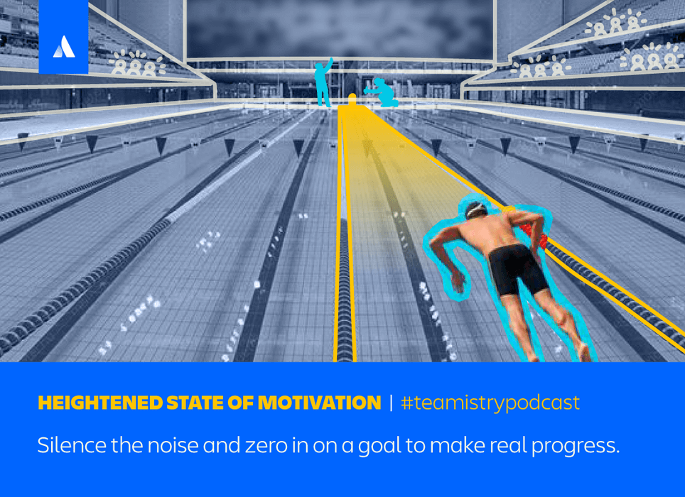
The blend of unique and overlapping skills and talents helped the team prosper. They were a heads down group, with a clear mission and their mix helped them thrive together. No, there wasn’t any money, yet, and maybe that wasn’t the most enjoyable part of it anyway. In fact, the lack of money helped them stay focused. “Living on ramen soup,” recalled Lars, “kept us incredibly focused on the task.” Lars called it a “heightened state of motivation.”
The close quarters the team shared also meant they shared lunch together every day, gathered in the tiny little kitchen talking about the project. “Different opinions were heard,” said Noel. “We’d sift them all together and then the ones that percolated to the top, we’d all decide they’re the best ideas, and just go with them together. When we made a decision as a team, we moved on, and just continued to move forward as a team.”
In other words, the team didn’t second-guess its decisions. They committed to them once they were made, embraced and acted on them as a group. But, just when they were getting their latest prototype ready, and the team was really gelling, two potentially project-crashing things happened: Yahoo launched its map software, and some funding that the Where 2 team was hoping for, from a venture capital firm, fell through.
Fun fact
Jens Rasmussen designed the red upside down pear shaped classic location icon in all map apps.
There goes plan A.
Time for plan B?
Their plan B is to pitch to a real estate company. But they know, in their hearts, that this is really unlikely to be successful. There isn’t enough money there or enough interest to take Expedition to the next level, to compete with Yahoo. They’ve reached another fork in the road, and it’s their lowest point on the journey so far. But, just when it looks like they might have to throw in the towel, they get a sliver of hope. The venture capital folks, the ones who’d just rescinded funding, still want to help out. They introduced the Where 2 team to Ram Shriram, a legendary businessman and one of the first investors in Google. He really liked what they were doing. And though he didn’t provide the funding, he had a great idea.
Said Lars, “He told us, ‘Look, the same reason that investors are nervous about investing in you, namely that big player Yahoo is rumbling in your space, might actually make Google want to buy you.’”
Because, it’s easy to forget, Google and Yahoo were fierce competitors at the time. So, the team changed directions. They went all-in on a new plan. Their new focus: if they can get Google interested, with the company’s might behind them, they could leapfrog the competition. But without Google, they’ll probably never be able to scale up their software. It will all be over. The end of the road.
And there’s a catch: Google wants to keep everything in the browser. They weren’t so hot on the idea of a separate app. Which is, of course, how Expedition worked.
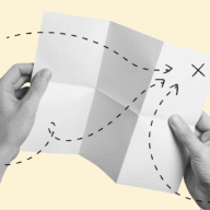
But the team was undaunted. They discovered some online articles about what was being called “dynamic HTML.” They really dug into it, and found that if they really pushed the limit of the browsers, they could get almost the same experience. Which is to say they might be able to replicate some of their more complex coding, because browsers now had their own more robust coding, thanks to JavaScript. Figuring out how to do it started with a brainstorming session, and a whiteboard. (Of course!)
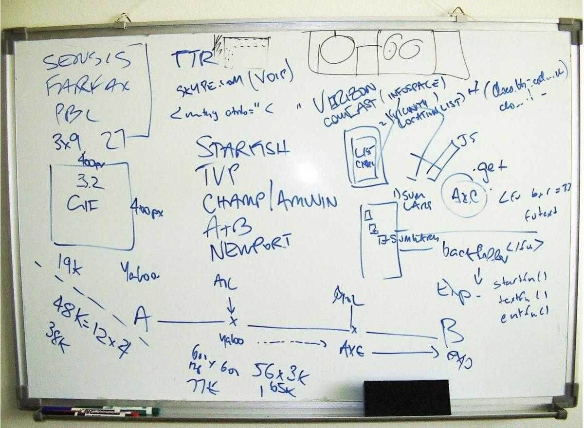
The original whiteboard. It’s like the classic “back of a napkin” drawing of what their map software was going to become. It was actually a roadmap for the next three weeks: things they must achieve to stand a chance to impress Google.
Embrace the detour
The most critical drawings on that whiteboard, are points A and B. “A” is their map technology in its current state: a C++ application that people have to separately download and install onto their browser. “B” is the point they need to get to if they want Google to buy in. And that means running the map completely on the web, by using dynamic HTML and Javascript to send and retrieve map data in the background. This means the browser won’t freeze up or have to be reloaded while searching for an address or displaying map tiles—the experience won’t be interrupted. Well, getting from point A to point B is the most difficult journey for the team.
It wasn’t a straight line, even if what’s on the whiteboard looks like one. But the team believed it could make something better. “What you are looking at is hope,” said Noel. “This is us changing and thinking and moving on as things change.”
The team channeled their passion, drive, and commitment – and hope – in a new direction, looking for a path to success. They endure three intense weeks of coding to get an app that works in the browser. Which they then presented to Google co-founder Larry Page.
“We showed them this thing,” said Lars, “that was quite unique. Not just because of ideas and maths, but because of the way it used the browser. It was a new way of making a much more dynamic webpage. Everything is built like that now, of course, but back then it was quite novel. I think we quite impressed them and we’d actually quite impressed ourselves to be honest.”
They did more than just impress Google.
“Just three weeks before we felt we were dashed and on the rocks and without options,” said Noel. “And then we were introduced to Google, and three weeks later it’s all over and we’re getting acquired.”
But that’s not the end of the road
In October of 2004, Google acquired Where 2 Technologies. You may be thinking: that’s it, they’ve done it. The dream of every startup, bought out by a huge company. In other words, you’ve arrived at your destination. End of story.
Nope.
Expedition was still only a prototype. A new road stretched out in front of the Where 2 team: they’ve got to figure out how to complete their app within the new working environment of Google.
In early 2005 Lars, Jens, Noel and Steven moved out of their tiny apartment and into Google’s Australian campus. They got there by doing things their way, but Google is unfamiliar territory. There’s one challenge in particular that they aren’t used to: working with other startups and teams. For example, another startup bought by Google, Keyhole (what would become Google Earth) – used to be competitors.
The reaction at first was to feel like they’re still in competition, fighting over resources and trying to outdo each other. But working in the small campus environment, hanging out together, having lunch, naturally leads to a connection.
“I remember that a contest arose over a lunch,” said Noel. “There was bet on that we couldn’t integrate satellite tiles into maps in some number of days. And the maps team said, ‘Sure, we’ll take that bet. Losing team takes the other team out to dinner!’ It was game on.”
In just five days, the maps team integrated Keyhole’s satellite tiles into their own software. And yes, they got a free dinner and bragging rights, but something more important happened in the process: they expanded what their mapping software can do – it now included a satellite view, not just illustrated tiles – but a fruitful, collaborative relationship started with their new coworkers, and teammates.
In fact, Google nurtured this environment for their teams, encouraging collaboration over competition.
“Rather than forcing us to integrate the two,” said Lars, “they let us have these two products that played quite a different role. And then we did a bunch of cross pollination, Google Maps got all of the amazing satellite images that the Keyhole team had assembled, and some of the search technologies that we built with Google around searching for addresses, searching for businesses, searching for things on a map, we then made available in Google Earth.”
What had seemed at first the challenges of joining Google, turned into a very workable situation because the Where 2 team realized their and Google’s core values were very closely aligned. “We learned a lot of our values from looking at Google,” said Lars. “How Google thought about always putting the user experience first and letting monetization come later. It was more like Google already had the culture that we were inspired by, and going there, just like, enhanced our ability to do that.”
In February 2005, after years of development, integration, and more development, Google Maps launched. It was a huge hit from day one.
“Our vision,” said Lars, “was once we had all the world’s geographical data in a web browser that was easily accessible, or any mobile phone that was accessible to everybody, that we’d all see each other from above in all parts of the globe. And it might help us realize that we’re all in this together.”